The Roman Project
Located in Cote-Nord, Quebec
MINERALS OF INTEREST:
Lithium
LOCATION:
Eastern Quebec, Cote-Nord Region
SIZE:
~6,500 Hectares
STATUS:
Active Grassroots Exploration
OVERVIEW
-
Property located in Cote-Nord, Quebec
-
Highest recorded lithium value in grab samples in northeastern Quebec
-
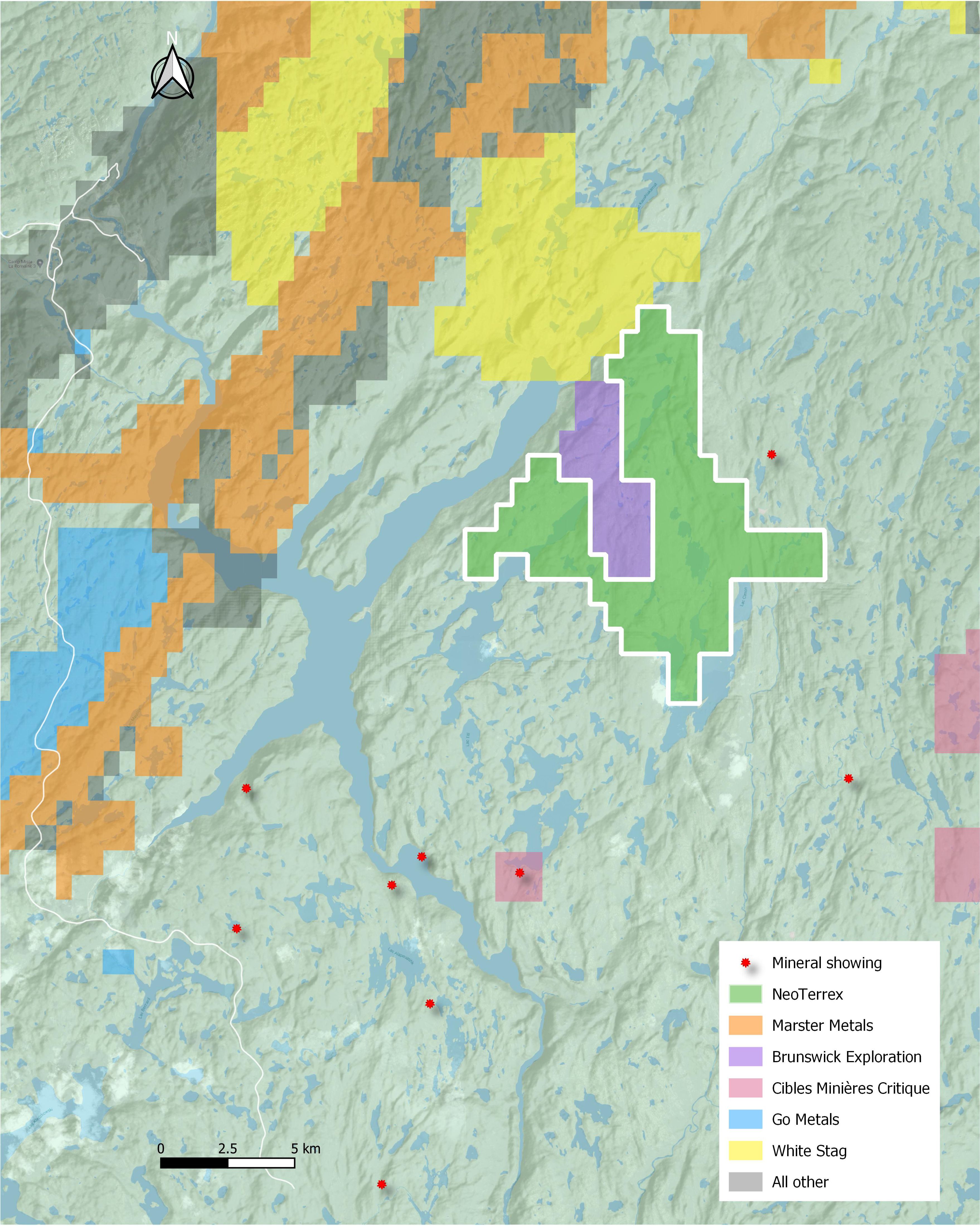
Adjacent to Brunswick Exploration
-
Prospective geology, with several known pegmatites
-
Unexplored since 1997
-
Road, camp and power with hydroelectric dam located with 30 kilometres
- Mining-friendly jurisdiction
Introduction
Location and Infrastructure
The property is located 92 kilometres of Havre Saint-Pierre, Cote-Nord, Quebec and is accessible by helicopter only. A new hydroelectric dam (La Romaine 3) was recently built approximately 25 kilometres northeast of the property which is accessible by an all-weather road.
Geology
The property is located in the west margin of the sedimentary basin from oriental segment of the Grenville Province. This basin, with an area of more than 8100 km2, includes mainly metasandstone, metapellites and effusive metavolcanites or hypabyssal from mafic to felsic compositions. This sedimentary sequence is designed here by the Wakeham Group. To the west, it is in contact with the Buit Complex. The Buit Complex is an assemblage of gneissic, felsic and foliated intrusive units with some amphibolites and sediments enclaves. Further west, this complex borders the Havre-Saint-Pierre rocks.
The property is entirely located in the Buit Complex, mainly within the foliated granite with biotite and muscovite with locally pegmatites. A small portion of the northeast part of the property shows a presence of the biotite, muscovite, garnet and sillimanite paragneiss with quartzite.
Locally, some amphibolites and gabbroic enclaves were recognized during a government regional mapping in 1997, mainly in the southern border of the small lake to the north of the LaFrance Lake. Several pegmatitic dykes were also identified in the same program. These pegmatites are moderately foliated. They are mostly composed of quartzo-feldspathic material. These rocks are also reported to contain biotite (1-15%) and muscovite (1-3%). Accessory minerals are sphene, zircon and allanite.
Exploration History
Past exploration work is limited the survey completed by the government in 1997, in which a grab sample (No. 1997013454), located in the southern border of a small lake in the central portion of the property, has revealed an anomalous value of 442 ppm Li and some significant values of 830 ppm Rb, 258 ppm Zn and 300 ppm Zr. No follow-up work was undertaken thereafter.
NeoTerrex Work
NeoTerrex will begin exploration on the property in 2024. Initial efforts will focus on locating and assaying the numerous pegmatites and reconnaissance geological mapping.
High-grade critical rare earths at surface
Highest recorded lithium value in grab samples in northeastern Quebec